


Adams 63, Adams County, Colorado
About
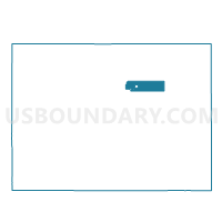
Outline

Summary
| Unique Area Identifier | 546393 |
| Name | Adams 63 |
| County | Adams County |
| State | Colorado |
| Area (square miles) | 0.41 |
| Land Area (square miles) | 0.40 |
| Water Area (square miles) | 0.01 |
| % of Land Area | 98.28 |
| % of Water Area | 1.72 |
| Latitude of the Internal Point | 39.84292160 |
| Longtitude of the Internal Point | -104.97653080 |
Maps


Graphs
Select a template below for downloading or customizing gragh for Adams 63, Adams County, Colorado


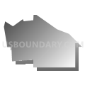


Neighbors
Neighoring Voting District (by Name) Neighboring Voting District on the Map
- Adams 62, Adams County, CO
- Adams 64, Adams County, CO
- Adams 69, Adams County, CO
- Adams 80, Adams County, CO
- Adams 81, Adams County, CO